Land
जमीन
In western Avadh, most people's diets were closely linked to the cultivated and uncultivated foods available in the physical landscape around them. As the land was transformed and cultivation practices changed, so did diets. From ancient times, humans have occupied the Gangetic plains and altered the landscape - deforestation at the advent of the Iron Age (around 1000 BCE) was one of the earliest of these. Inhabitants and rulers continued to transform the land by constructing ponds and linking them to rivers, building embankments etc., but changes in the colonial era and the decades after Independence were broader and more far-reaching. The Sarda canal, built in the 1930s, substantially increased the acreage of irrigated land. It also led to the reduction of wetlands - thousands of acres of low lying land were drained by drainage channels and subsequently cultivated year-round. Tubewells and borewells in the post-Independence period further expanded irrigation, while bunding and levelling of land by government agencies made it more 'productive'. Green Revolution crops - wheat, paddy and sugarcane could now be grown in a larger area, and these overtook barley, millets, pulses and oilseeds in acreage. Other policies led to changes in the land. Land reforms in the 1950s gave land rights to the tillers, freeing them to improve cultivation. Ceiling laws, passed to limit landholdings, resulted in big landowners relinquishing their marginal lands to the landless. These lands, previously left uncultivated, were now brought under cultivation with the help of irrigation and land improvements. Land earmarked for homes, pastures and other purposes was often grabbed by powerful farmers and converted into agricultural land. The drive to cultivate became so unrelenting that wide borders between fields - med - were narrowed and the trees growing on them cut down. Presently, land outside habitations is almost completely agricultural, with most trees found in orchards or plantations. Only small patches of land by the rivers remain wild.
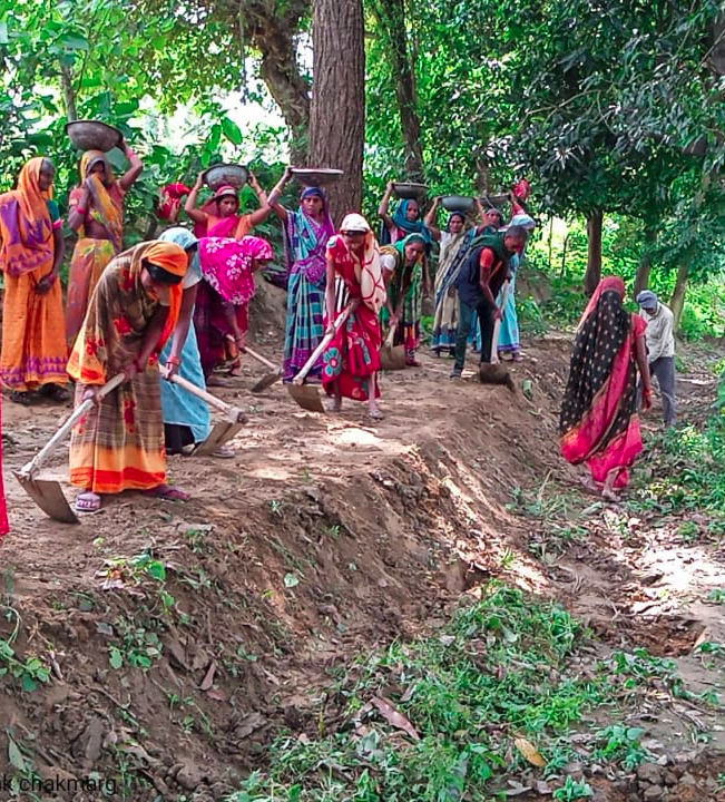
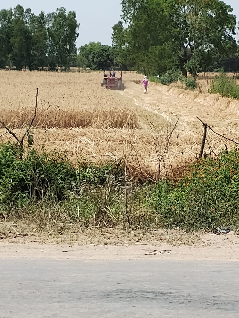
आहार में परिवर्तन बड़े पैमाने पर भूमि के परिवर्तन से जुड़ा है। जैसे ही जमीन से जुड़ी प्रक्रिया बदली, वैसे ही खान पान बदल गया। भूमि का परिवर्तन सरकारी नीतियों से हुआ, जैसे भूमि सुधार, भूमि समतलीकरण और सिंचाई। अधिकांश परिवर्तन ब्रिटिश काल में शुरू किए गए थे। लेकिन स्वतंत्रता के बाद, विशेष रूप से हरित क्रांति के दौरान, यह बदलाव और तेज हो गये। ऐतिहासिक रूप से इस क्षेत्र में खेती करके और बटोर के - दोनों ही प्रकार से खाद्य पदार्थ उपलब्ध थे। खेत, परती, जंगल, झाबर, तालाब, नदी सब ही खाने के स्रोत थे। राजाओं ने छोटे बांध बनवाए, लोगों ने तालाब खोदे और उनको आपस में जोड़कर पानी का संग्रहण करा, सिंचाई और अन्य कार्यों के लिए। लेकिन अंग्रेजों के राज में एक बड़े स्तर पर बदलाव आया। 1930 के दशक में शारदा नदी पर बांध बनाकर, उसका पानी नहर के जरिए सीतापुर और आस पास के इलाकों में पहुँचाया गया। इस से सिंचित रकबा बढ़ गया, लेकिन पानी के निकास के रास्ते बंद हो गए, और कई इलाकों में जल भराव की स्थिति बन गयी। पानी के निकास के लिए नाले बनाए गए और साथ ही हजारों एकड़ झाबरों को भी जल मुक्त कर दिया, जिससे वो जमीनें जोत में आ सके। आजादी के बाद 1950 के दशक में भूमि सुधार अधिनियम के अंतर्गत जोतकारों को जमीन मिली। 1960-70 में भूमि सीलिंग में बड़े जमींदारों को अपनी परती जमीन छोड़नी पड़ी। यह जमीन 1970 के दशक में कुछ गरीब भूमिहीन दलित परिवारों में बाँटी गयी। लेकिन कई बार उपजाऊ जमीन शक्तिशाली किसानों के कब्ज़े में ही रह गई। दलित परिवारों को बेकार जमीन ही मिल पाई। 1960-70 के दशक से ट्यूबवेल और बोरिंग से भी सिंचित रकबा बढ़ा, और हरित क्रांति के अंतर्गत समतलीकरण और मेड़बंदी से भूड़ की जमीन में पानी रुकने लगा। इससे भूड़ में गेहूं, धान और गन्ना होने लगा। इन तीन फसलों ने जौ, चना, मोटे अनाज और दलहनों को पीछे छोड़ दिया। हरित क्रांति के चलते शक्तिशाली किसानों ने परती, चरागाह, झाबर, झील और अन्य जमीन को भी खेती में ले लिया - इतना ही नहीं, खेतों के बीच की मेड़ों को भी खत्म कर दिया, उनको को बड़ा करने के लिए। मेड़ों पर लगे हुए पेड़ों को काट कर हटा दिया गया। अब पेड़ केवल बागों में या सड़क किनारे पाए जाते हैं। नदी किनारे बस कुछ ही क्षेत्रों में जंगल रह गए हैं।
जानकारी जल्द आ रही है
Information Cards
Caste:
Geography:
Seasons:
Media Type:
Caste: All
Geography: All
"After Independence, about half of Ballapur's residents got rights to some land - the land that they were permanently cultivating. But most of the land that they cultivated was on short-term lease (kooth) and they did not get ownership of this land"
Caste: All
Geography: River bank
"In the late 1950s, the Gomti river changed its path and deposited a huge pile of sand on Pitouli's more fertile lands. We had to move our village a kilometre inland, and lost about half of our landholdings"
Caste: All
Geography: All
"The chakbandi in Wazirnagar Panchayat was conducted in 1963. Then, the ceiling laws weren't in effect, so not much land was freed up. Whatever parthi zameen was available was distributed. We didn't know that we had to ask for common lands during the Chakbandi, so there was no grazing land allocated in our village. Grazing lands were identified in other villages in our Panchayat."
Caste: Savarna
Geography: Sandy soils
"The Ballapur zamindars were the first to grow trees in the bhur region. Their orchard was planted in anticipation of the ceiling announced in 1966-67. The ceiling for orchards was higher, so this was one way of protecting land. Desi mango trees take about 8 years to fruit."
Caste: All
Geography: All
"The Yadavs in Jajpurva owned more land, the Paasis less. Yadavs bought more than 30 bighas of land from Saadatnagar landowners and increased their holdings. Meanwhile, the Paasis did not sell land, but their landholdings dropped due to having large families"
Caste: All
Geography: All
"Pattas were made to landless or marginal landholding families in Ballapur, but the land was not distributed - the zamindar family is very powerful. My family got a patta, but we don"t even know where the land is."
Caste: All
Geography: All
"There was grazing land (40 bighas), land for homes (6 bighas), khalihaan (threshing ground) and a playground. Now they are all encroached by villagers"
Caste: All
Geography: All
"There was forest land near the road and 27 bighas of grazing land, now very little is left"
Caste: All
Geography: All
"Chakbandi took place in Sundarpurva in 1970-75. Our forefathers were not knowledgeable, they thought 'we will get a good chak (piece of land) for ourselves'. Instead, a lot of good land in Sundarpurva went into the hands of Saadatnagar farmers"
Caste: All
Geography: All
"Sataana had 3 bighas of land. Her husband had a vasectomy and they were allotted 5 bighas, though only half came into their possession. Some 5-6 families got 2 bighas each in our village after having vasectomies."
Caste: All
Geography: All
"In Bareliya Gram Sabha the land ceiling limits, set at 15 acres, were implemented during Chakbandi in 1979-80. No one had land above the limits, but 2% was taken from every landowner. Some forest land was distributed, but most of the land distributed to the landless or marginal farmers was on a sloping channel between two rivers. The Soil Conservation Department built bunds, then cut terraces into the channel. These fields are now irrigated and farmers cultivate wheat there."
Caste: All
Geography: All
"Earlier, there was a lot of rain and land flooded from Maliyani to Sultannagar (3 km). When the canal was full, it would be breached and the water filled the jhaabar. The jhaabar connected with the Gomti river through the canal. Short-term pattas were given to families on the edge of the jhaabar in the 1980s, but they continued to cultivate there even after the pattas expired. As the jhaabar receded, they encroached on the exposed land."
Caste: All
Geography: Forest
"The Soil Conservation Department worked on our village forest. It was divided into 4 parts and bunds were built, trees were planted. But many of the trees were uprooted and stolen – people planted them on their own land. Then, the new Pradhan took up tree planting, but he selected diesel trees (jatropha) and not fruit trees. They are of no use to us. Earlier, we were scared of entering the forest - there were bandits, but now kids play there. Now it is a jungle in name only"
Caste: All
Geography: All
"During the early days of the MGNREGA struggle, in 2006-07, ponds were built in the Miyapur jhaabar. That time there was still water in the jhaabar. But gradually the rains reduced and even the ponds did not fill up - only in years with heavy rainfall do they fill up. When digging the ponds, the soil dug out was spread in the jhaabar and maybe that elevated it. Anyway, the jhaabar is dry now and people farm there."
Caste: All
Geography: All
"Malathi's father-in-law owned 90 bighas of not-so-fertile land. It was distributed between his two sons. Malathi has 5 sons and 3 daughters – each son will receive 9 bighas. One son has two sons, so it will be further divided. So, over 4 generations, the landholding has dropped sharply"
Caste: All
Geography: All
"There are 3 lakes in Wazirnagar and 3-4 lakes in Miyapur. The contracts for fish in these lakes were auctioned just last year by the Tehsildar – these are 10 year contracts. Some people in Miyapur took these contracts. Earlier, this was done by the Pradhan but now the government wants to manage these directly. These lakes are not getting filled, so how will they get much fish? But the contract amounts are very low - three or four thousand, so maybe it is ok for them"
Caste: All
Geography: All
"The jhaabar near Rannupur spanned seven villages. But after a drainage canal was built, the water has receded and powerful farmers have taken it over. They cultivate paddy and sugarcane now."
Time Line
1930s
Sarda canal - irrigation and drainage
The Sarda canal was opened in 1932, providing irrigation waters to an estimated 1 million acres. Networks of drainage channels were also built at this time to drain jhils and low lying lands, which had provided irrigation in the past. These were now converted to agricultural lands
1950s
Post-independence, the Zamindari Abolition and Land Reforms (ZALR) Act was passed, transferring land from landlords to the tillers. A large number of farmers, mainly from dominant and backward (Yadav, Maurya) castes became landowners.
A series of floods ravaged the region in the 50s and 60s. Drainage canals were built to divert the water into rivers and prevent flooding
1960s
The Land Ceiling Act was passed to limit the amount of agricultural land held by a single family. While this freed up more land for redistribution, large landowners used various strategies to bypass this and retain most of their land. The ceiling land given to the government was often of poor quality
The Land Consolidation Act was passed in the 1950s, through which all lands in a village were assessed and consolidated. Thus joint family land was distributed among inheritors, fragmented landholdings converted into one or two parcels etc. Existing landowners had to give up a portion of their land (2-6%) - this and other available land was distributed to landless families. Land Consolidation or Chakbandhi was taken up in the region starting in the 60s and continues until today
1970s
Garibi hatao' (eliminate poverty) campaign
The 'Garibi Hatao' campaign was launched nationally to give land to the landless peasants. Pressure from above drove revenue officials to identify available land and distribute it to landless families.
Land was provided in a few villages to men who underwent sterilization
1980s
Newly distributed lands were often marginal lands, either undulating or lowlying, vulnerable to soil erosion and not suited to cultivate irrigated crops. The Soil Conservation Department, set up in the 1960s, began undertaking land improvement projects in the region, mainly bunding and leveling of fields. Punjabi farmers moved into the area and began levelling their fields using tractors, and local farmers picked up this practice.
2000s
Under MGNREGA, levelling of Dalit farmers' fields could be taken up and many fields were levelled under this provision